Precautions for the use the app:
・When an incorrect time period is set or a short time period (less than a month) is set, the app may not be able to process data.・It may take long time to process Landsat images as the data size is large.
Please stay tuned until all the data are being loaded.
Variations in phytoplankton biomass
Spring CHL bloom
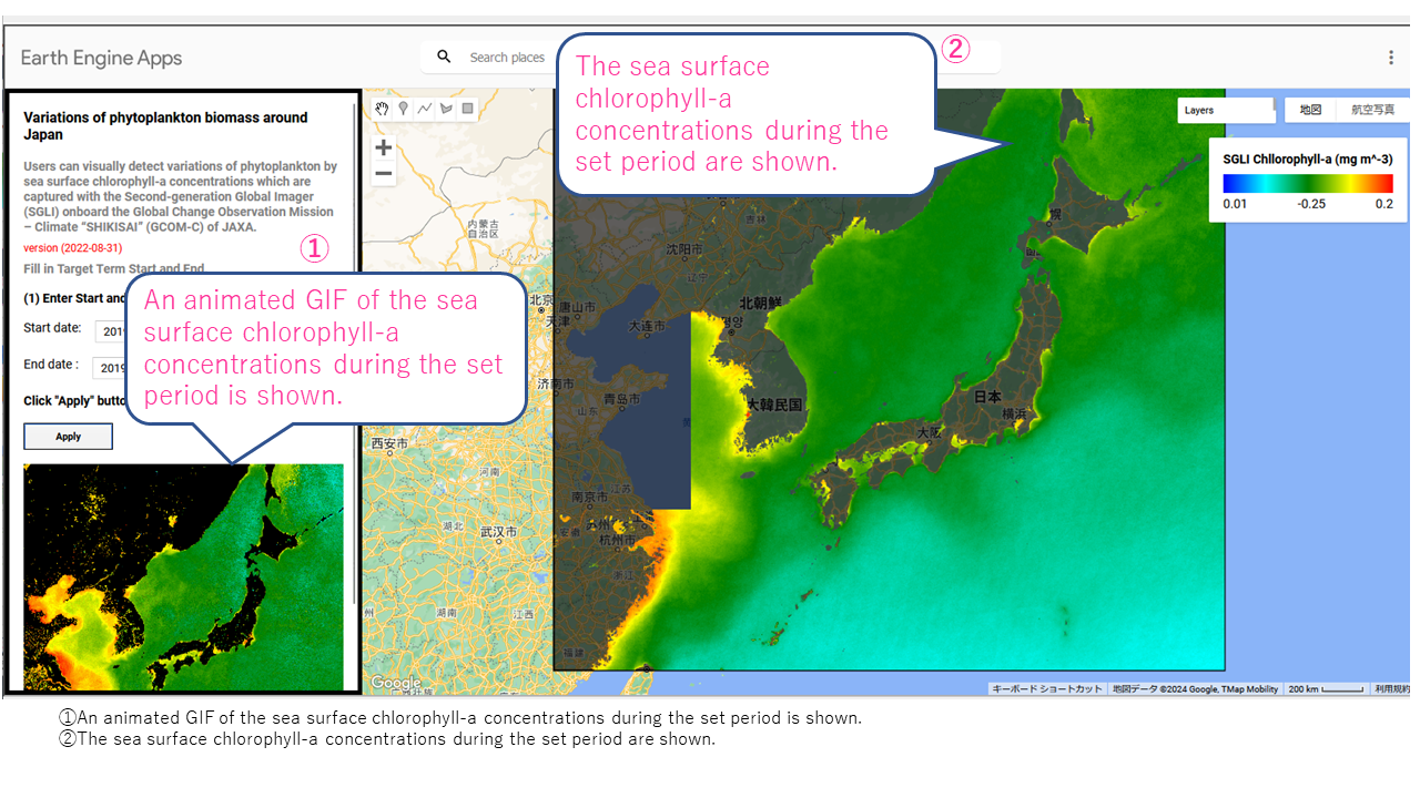
Spring CHL bloom (high chlorophyll-a concentrations) moves northward from the south in the northwest Pacific from January to December in 2019.
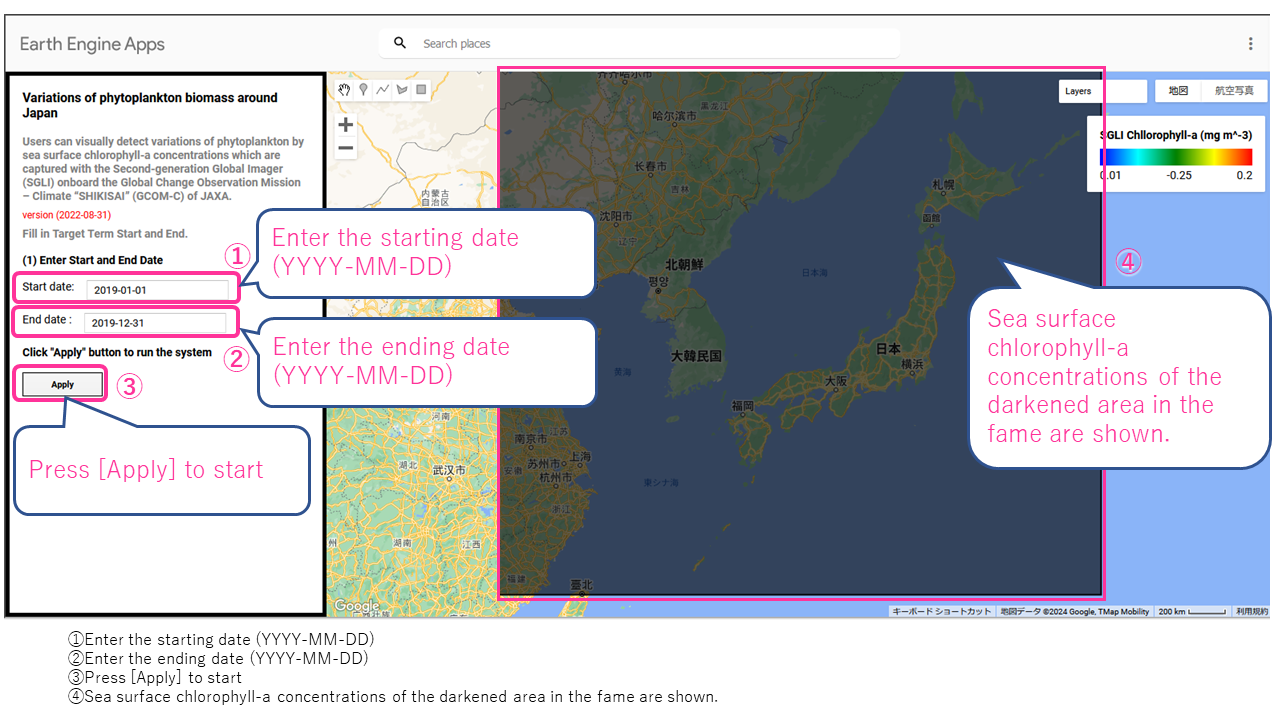
(1) Enter “2019-01-01”in the starting date.(2) Enter “2019-12-31” in the ending date.

(3) Press [Apply] to start, and the seasonal variations of chlorophyll-a concentrations from January to December 2019 are shown.
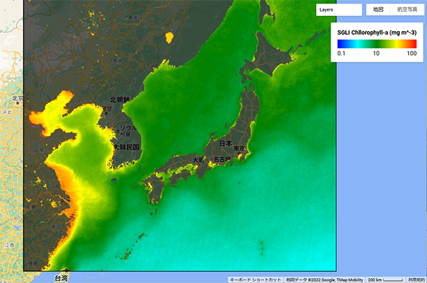
From January to April, the sea area with high chlorophyll-a concentration, which is used as an indicator of phytoplankton, moves northward from the south in the northwest Pacific.
This phenomenon is called “spring CHL bloom,” and it contributes to nurturing marine biodiversity.
https://www.isee.nagoya-u.ac.jp/50naze/oceanography/38.html (Japanese)
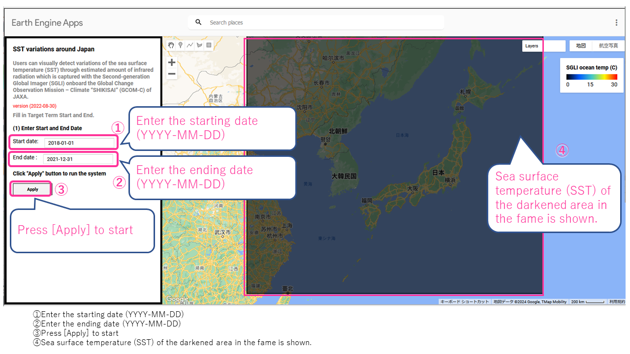
SST Variations
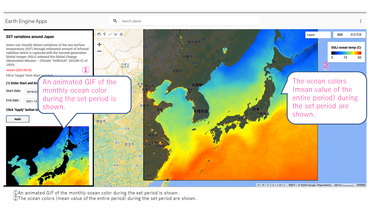
Kuroshio meanderings
From January 2018 to December 2021, the warm current Kuroshio meandered largely south of the Kii Peninsula, Japan
(1) Enter “2018-01-01” in the starting date(2) Enter “2021-12-31” in the ending date

(3) Press [Apply] to start, and the imagery of monthly mean is shown below the [ENTER] button, and the mean imagery from January 2018 to December 2021 is shown on the map.
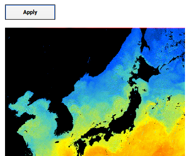
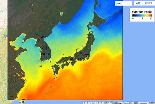
The mean imagery from January 2018 to December 2021 on the map indicates large menders of the warm current Kuroshio south of the Kii Peninsula, Japan.
According to the Japan Meteorological Agency (JMA), this large Kuroshio meanderings occurred in September 2017 and has continued by now.
It is well known that Kuroshio meanderings influence on fishery as well as flood disaster and the climate
https://www.nhk.or.jp/kaisetsu-blog/700/469538.html (Japanese)
Comparison of Landsat imagery
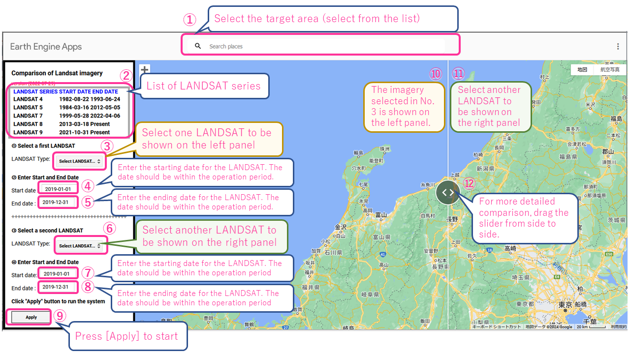
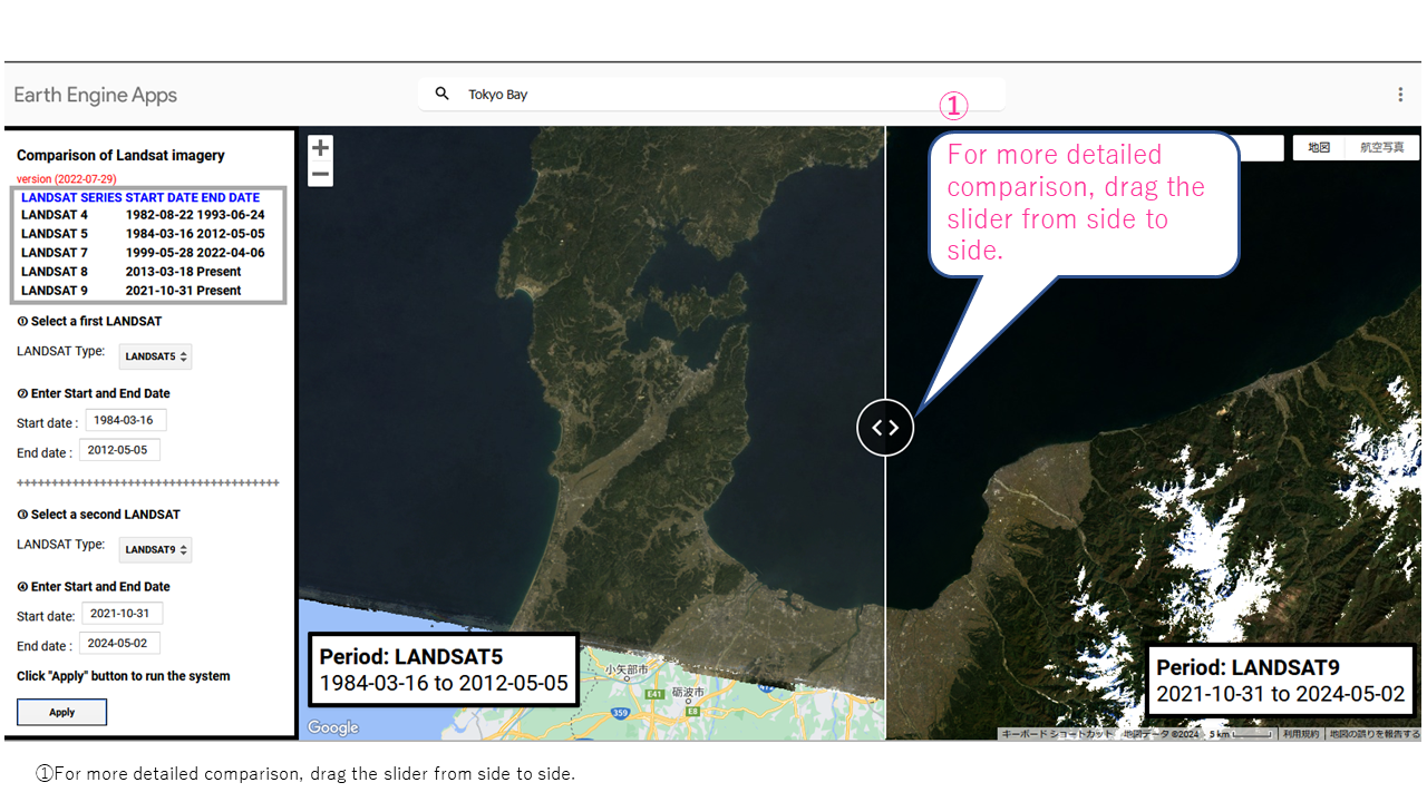
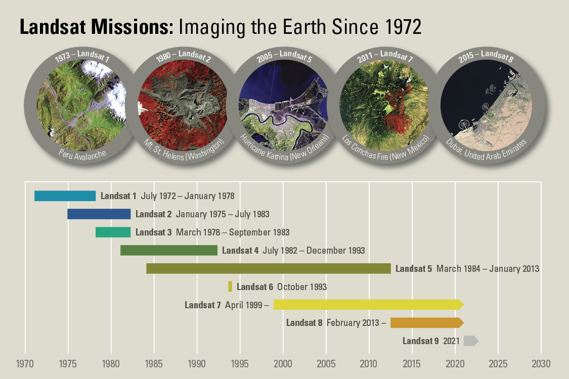
LANDSAT 4 -9
LANDSAT is an earth observation satellite of the National Aeronautics and Space Administration (NASA) of the US. LANDSAT 4, launched in 1982, can monitor the earth surface at 30 m resolution by using optical wavelength and near infrared rays.With enhanced quality of sensors in recent years, the surface of the earth can be observed more precisely
https://sorabatake.jp/25427/ (Japanese)
https://www.usgs.gov/landsat-missions/landsat-satellite-missions (English)
https://www.usgs.gov/media/images/landsat-missions-timeline
Time-lapse